After we left Cuyahoga National Park, we were ready to visit some family in Wheeling, West Virginia. I had no idea what to expect, but after charging up south of Cleveland (and struggling with some of the non-pull-thru stalls at a Flying J), we quickly figured out that we were in Appalachia. The freeways started getting a lot curvier and going up and down a lot more hills. Then, we left the interstate and used roads like US-250 and Ohio SR-9 to shave some miles off and get more of a straight shot to wheeling.
Sadly, we were in a bit of a hurry to make it to a campsite, and didn’t have time to set up for any photos or video. We saw beautiful things like Tappan Lake and post-apocalyptic mining wastelands near Cadiz. Honestly, I thought it would be a lot like driving across the Appalachian portions of Tennessee and North Carolina (endless green hills), but I was surprised at some of the variety.
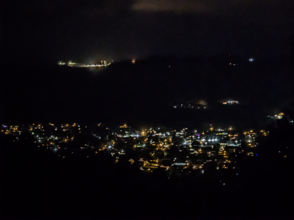
When we arrived in the Wheeling area, this was the view from the RV park at Grand Vue Park (next to Moundsville):
The next day, I got a shot of the campground at Grand Vue:
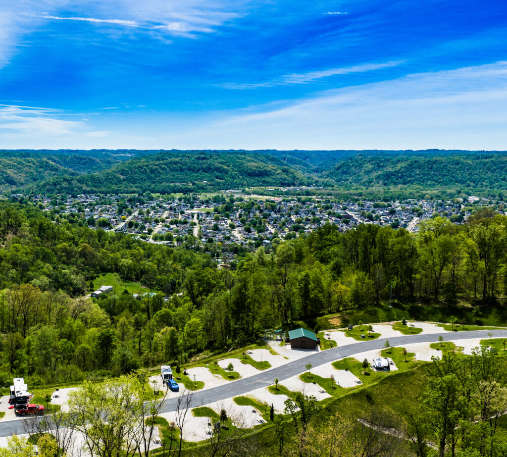
As you can see, the campground wasn’t super busy in late April. Again, this is up north and the season when everything is warm and open starts later. Sadly, we couldn’t check out the zip lines or anything fun like that because it wasn’t open yet. So, we spent the next few days meeting family and checking out the area. There were lots of tunnels, roads on steep hills, bridges, and basically everything you’d find in a severely mountainous place.
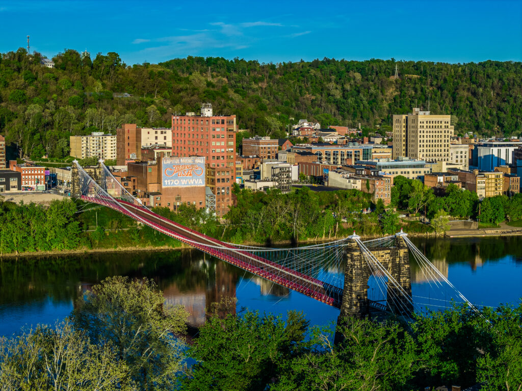
It was also a lot of fun learning about the history of the National Road. Before trains really took off, the United States focused on building wagon roads, and the federal government only wanted to fund one from Cumberland, Maryland (as far up the Potomac as you could take a large boat) to Illinois. The goal: to make westward expansion easier. It may seem unimaginable now, but at one point Wheeling was the western frontier, and it was both expensive and of questionable wisdom to build a bridge across the Ohio River.
Later, the road that crossed at this bridge fueled the automotive boom, and became the “main street of America” before Route 66 swept in later and took the title.
The road out of Wheeling into Pennsylvania was again a mess of hills, tunnels, and tolls. The first tunnel was in Wheeling itself, going through a mountain that there was basically no way around at interstate speeds. Another big one was on the Pennsylvania Turnpike, and it ends with an abrupt turn. One of the turnpike plaza charging stations required me to park in front of some angry truckers who struggled to get out.
But, before long, I found myself exiting the turnpike to head down into Maryland and Virginia, and I had to exit into a somewhat internet famous town…
The Biggest Glitch In The Interstate Highway System
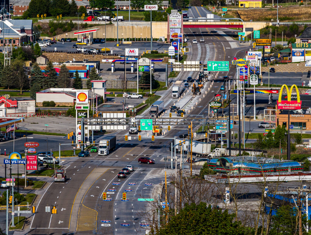
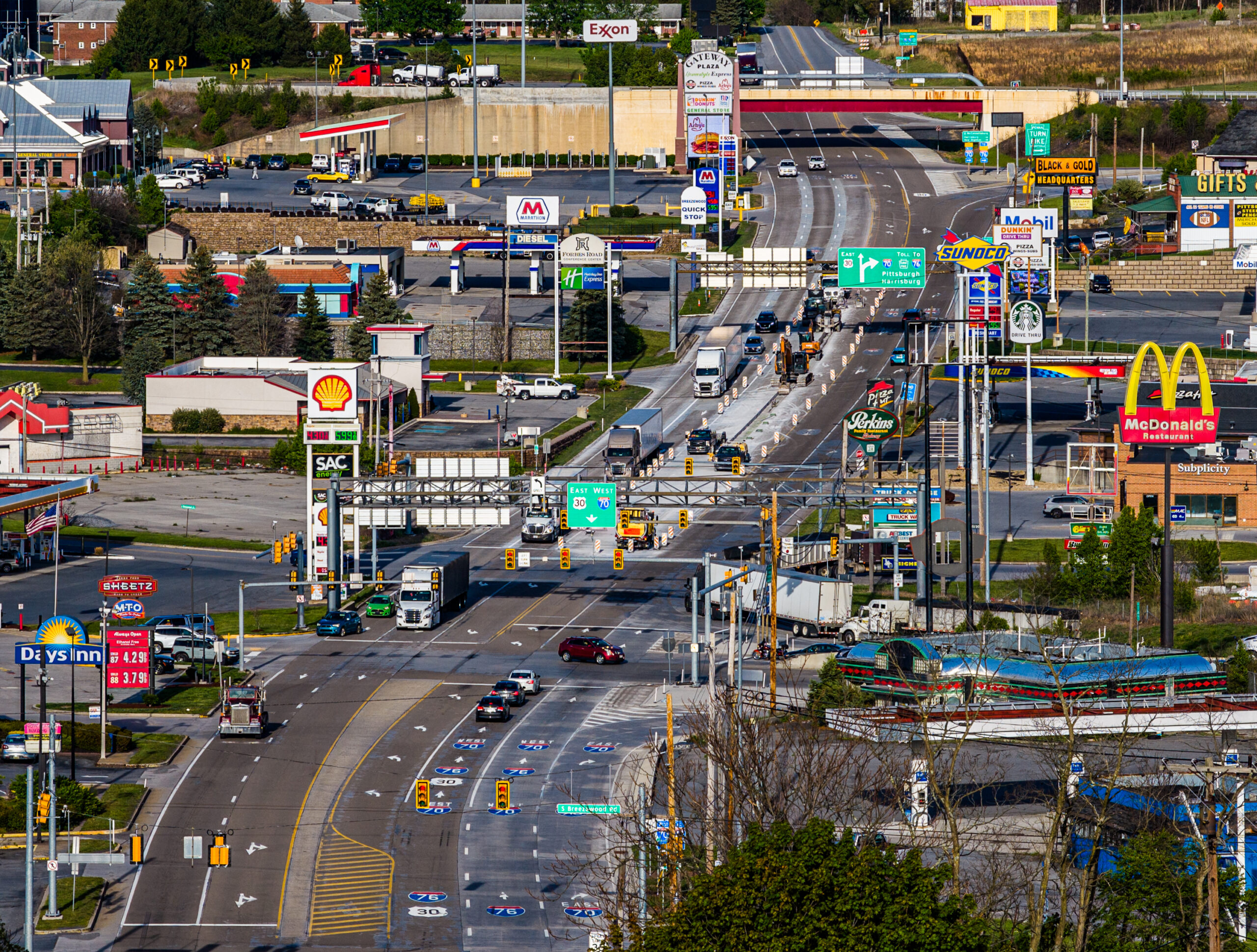
If you feel like you’ve seen this photo before, that’s because a very similar one has been floating around the internet since 2008 (I took the one above with my drone). If you look at the town of Breezewood, Pennsylvania from just the right angle with a telephoto lens that makes things look closer together, it looks like some kind of suburban American hellscape. Pavement everywhere. Capitalism everywhere. Fast food. Gasoline. Some have looked at this photo and declared Breezewood to be the most American place on the planet. And, it looks like it goes on forever.
But, if you actually visit the place and look at it from just about any other angle, you’ll find something more like this:
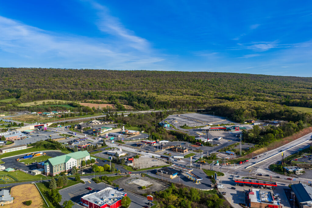
Yes, there’s a cluster of gas stations, fast food places, motels, truck stops, and a gift shop. That’s because in the 1950s, it was illegal to connect a toll road to an interstate without dumping motorists off first so they have a chance to take another road and avoid the toll. This chokepoint where I-76 (the PA Turnpike) and I-70 split off naturally attracted businesses looking to make a buck off the captive audience.
Sadly, this strategy didn’t work for many entrepreneurs. People can only visit so many businesses. Many of the places on this stretch are closed down, burnt down, or simply abandoned. This includes the place I parked to put my drone in the air and capture the photos. If you search for “Breezewood Urbex” or “Breezewood abandoned places” on YouTube, you can learn a lot more about this.
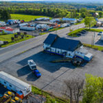
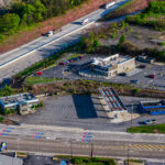
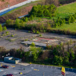
In the next few years, the state plans to connect the interstates directly, which might be a blow to Breezewood. But, given the already advancing decay in the town, it’s already becoming just another town on the interstate regardless of whether people have to exit before driving into Maryland and heading toward DC.
Heading Toward Shenandoah
From Breezewood, we headed south toward Shenandoah National Park. Along the way we stopped at a great little restaurant in Hancock, Maryland after driving only a mile to cross the whole state at what’s basically its skinniest point. We found a charming little combination antique store and restaurant that had a 20 kW charger across the street. Then, we headed south across a stretch of West Virginia and then Virginia. We stopped to charge a few minutes north of the national park, and then headed up on Skyline Drive, arriving at the campsite WAY too late. But, we managed to set up camp without waking anybody up.
In the next article, I’ll share what we found there on our electric journey!
Share this:

Discover more from Charge To The Parks
Subscribe to get the latest posts sent to your email.