When most people talk about the beginning of Route 66 in Chicago, they think about downtown. There’s a sign with the Route 66 shield that says “End” under it. There’s a cute little marker around the corner from that. The City of Chicago recently decided they were going to move the end of 66 to the Navy Pier, so you might go with that choice, even if it’s not historically accurate.
In this article, I’m going to share where I think Route 66 actually began, and it’s not downtown at all! I’m also going to share a couple of other cool things we saw when we were there.
As much as I love driving and RVing, I have to admit that US transportation history didn’t start with the automobile. To really understand Route 66’s routes, we have to go further back to trains, ships, and even as far back as the canoe! Let’s work this backward in time.
Highways Start and End in Important Places
First, let’s put ourselves in the shoes of highway planners. Before there were any US routes, there were auto trails. Vehicle owners, lacking good routes, made their own. Roads like the National Old Trails Highway, Lincoln Highway, and Dixie Overland Highway weren’t established by governments. Automobile clubs, local governments, chambers of commerce, and map enthusiasts would go out with buckets of paint and mark the highway routes on power poles, ranch fences, and trees. It was even joked that anyone with enough time and enough buckets of paint could create their own highway!
For groups of people interested in creating these early unofficial highways, there had to be a good reason. Put simply, there had to be an A and there had to be a B, and people who wanted to go from that A to that B. Auto trails started and ended in important places, and they went through as many important places along the way as they could.
When the first official national routes were put in place, they largely followed these existing auto trails. Because the auto trails served human needs, they naturally started in an important city and ended in an important city. So, naturally, Route 66 followed the same logic. Chicago and Los Angeles were important places because they had the #2 and #3 highest populations.
Why Chicago Mattered Enough To Be The Beginning of Route 66
Transportation infrastructure has always been about reducing friction. Walking is tough. Having horses or oxen pull a wagon is better, but still very slow. So, the US created some wagon roads to prevent people from dying on the way. Water transportation was still far more popular because water is slick. Pulling or pushing a boat, or better yet letting river currents push it for you, was the best possible way to move goods for a long time. So, in the early nineteenth century, many canals were built to move freight with ease into new areas.
As the Johnny Canal skit comedically illustrates, the cost of building canals was pretty high. You not only needed people to dig the canals, but you needed water to fill the canals, land for the canals to traverse, systems of locks and dams, and teams of mules to pull the boats. For this reason, it was always cheaper to use or modify natural waterways whenever possible. Canals largely were built to connect these natural highways to get the most bang for every buck.
When European-descended settlers and merchants first went into the Great Lakes region, they had to rely on indigenous guides to know where the hell they were going. For thousands of years, tribes and traders had been using canoes to go all over the continent. They knew all of the shortcuts.
The biggest problem for water-based traders was that the Mississippi River had no direct connection to the Great Lakes. If you could just get from Lake Michigan to the Mississippi or Ohio rivers, you’d have a fairly complete water highway system that could go all over the East Coast and Midwest! There was one place where this was almost possible:
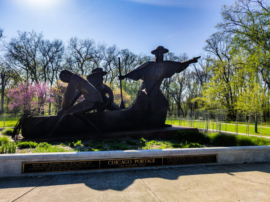
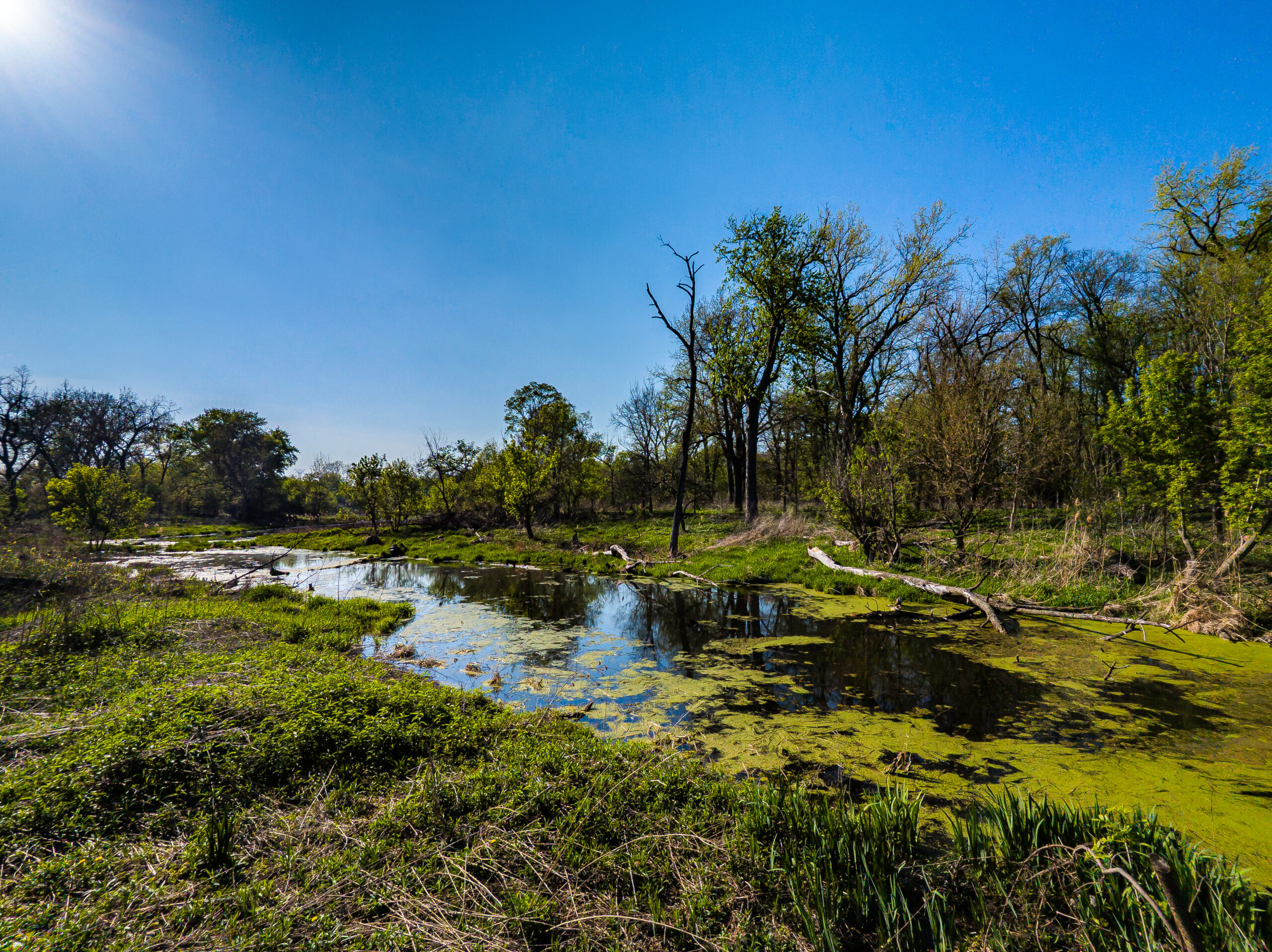
At the Chicago Portage, two rivers were separated by a small rise in the land. One river led to Lake Michigan. The other led to the Mississippi River. Between them was a swamp that native traders would drag a canoe through. Sometimes, it was almost paddle-worthy. Other times, it was a multi-hour slog through deep mud and clouds of mosquitoes. But, it was a shortcut between the river systems that was always worth the trouble.
 If you look at the Chicago’s flag, you can see this story. Dry land sitting between two major waterways, separated by the growing city. That growth became faster and faster as the swampy Chicago Portage was dredged, canals were cut, and then larger and larger ships were able to pass through between these two worlds.
When the US railroad network started, it made sense to run lines to and from places where freight was already moving. Because Chicago was already a place where vast amounts of goods and people were naturally going, it made sense to start rail lines there to reach places where canals weren’t feasible. Eventually, enough lines were going to and from Chicago for it to be a main hub of railroad travel all over the United States, and the city grew larger and larger.
By the time people were planning auto trails and highways, it just made sense for a major cross-country route to start there. And, because so many people and businesses were already in Chicago and Los Angeles, it became the most famous of the US highway system before the interstates started taking over.
So, in the end, I wouldn’t call downtown Chicago Route 66’s real birthplace. The idea of Route 66 started at what’s today called the Chicago Portage National Historic Site.

Route 66’s Zombie Section
Just a short distance from the Portage, you can find another really cool section of Route 66, but you can’t drive on it. Back in the late 1990s, a gravel quarry had been dug on both sides of the highway where it passed through McCook, Illinois just outside of Chicago. The quarry’s owners cut too close to the road, eventually causing the bedrock under it to buckle and fail. The state had no choice but to close the road for safety and re-route traffic on other roads.
The Zombie Section of #Route66 near Chicago.
— Jenn @ ChargeToTheParks ⚡️ (@chargetotheparks.com) 2026-08-03T00:34:27.565Z
Today, it’s a popular spot for zombie movies and other post-apocalyptic thrillers. If you keep the angles right, it really looks like Chicago has been abandoned!
A Famous House
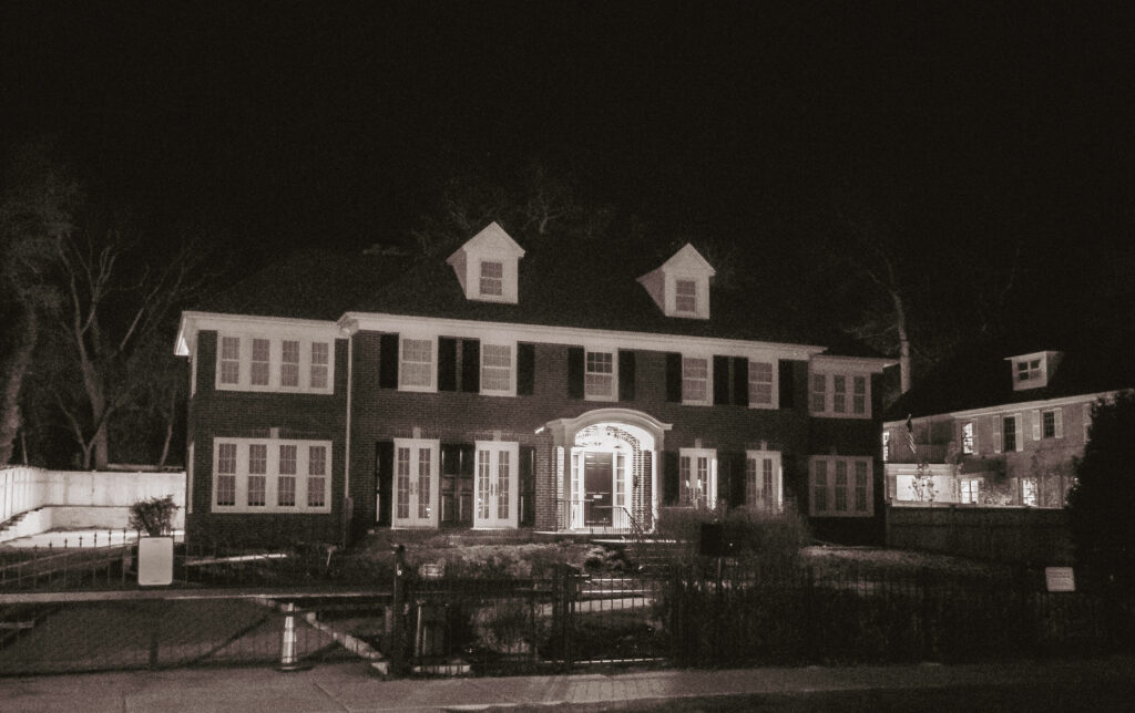
I couldn’t visit Chicago without stopping to see one of the area’s most famous houses. For those who didn’t recognize it right away, it’s the house from Home Alone, and it’s a half hour drive (outside of rush hour) from downtown.
Other Spots Worth Visiting
Before I conclude this article, one thing I’d recommend is not taking a travel trailer into Chicago. I left mine at Indiana Dunes State Park, and it was a good idea. Low bridges, crazy traffic, road rage, and many other things would’ve been tough with it.
While I was out there, I stopped at a number of other places, but not for long enough to get great photos. I, of course, saw the official ends of Route 66 downtown, including the sign and a quick drive to the end of the Navy Pier. I wasn’t supposed to go to the last one, but I did quickly get a turnaround at the end before anyone could tell me I passed a “buses and taxis only” sign.
One of these days, I’ll probably visit Chicago again and spend more time there. I did a lot of driving around and got a basic overview of the city, but there’s a lot more to see!
Share this:

Discover more from Charge To The Parks
Subscribe to get the latest posts sent to your email.